Hiking Kealia Trail: The Western Frontier of Oahu
Kealia Trail is one of the loveliest hikes on the island of Oahu, gifting its trekkers with glimpses of azul waters through its leafy vegetation, and offering some of the purest vibes around. You just don’t find that on all the hikes these days – pure vibes – that is.
Many hikes on Oahu have exploded in popularity in recent years, which is awesome! That means more people are getting out there and adventuring and appreciating the beauty and luster of Hawaii. But Kealia Trail offers something else. It caters to the nonconformist and those who have an inner longing to escape the crowds and noise of human activity. Kealia Trail is truly an undiscovered gem, in every sense of the phrase.
Like any other hike, it’s always helpful to be prepared with what to expect and general information. I like to call these brain preps. Yeah, Brain Preps, that’s what this is.
Brain Preps Overview
There are several length options for hiking Kealia Trail, so you can decide beforehand (or mid-hike, you spontaneous thing you) how extreme you want to go.
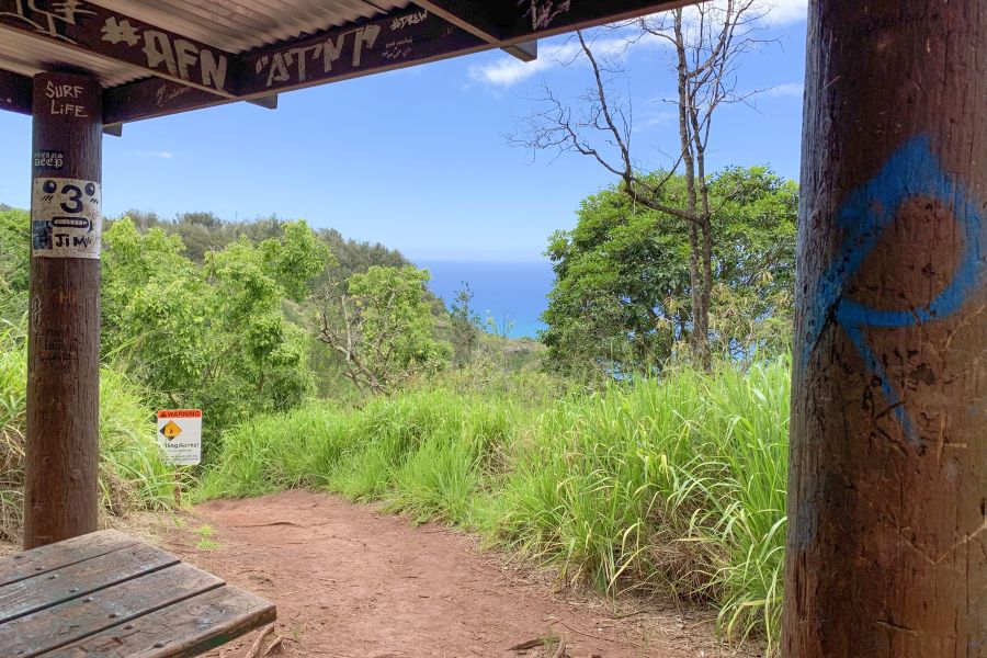
The first option, let’s call it Option A, is a one and a half mile switchback trail up to a large rest area with picnic tables, or about three miles round trip.
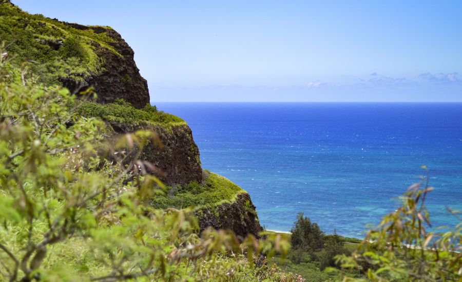
Option B takes you along a wide path (following the switchback trail) up to the summit and leads to breathtaking views of the Waianae coast.
Option C is an all day event for those of you who seek adventure and thrill (and are kind of crazy) where you follow the trail over the summit and down the other side of the mountain all the way to Makua Beach in Waianae.
We’re going to be talking about Option B, which gives you all you need to know about A and B and leaves mystery and adventure in your hands if you’re thinking about C.
Kealia Trail: The Hike
The first step is getting there, which can be a confusing process on its own.
The Trailhead for Kealia is at the furthest stretch of road on the westernmost part of the North Shore. It begins at Dillingham Airfield, which is an excellent GPS destination to plug in (because I don’t think there’s any other way to get anywhere these days, am I right?!).
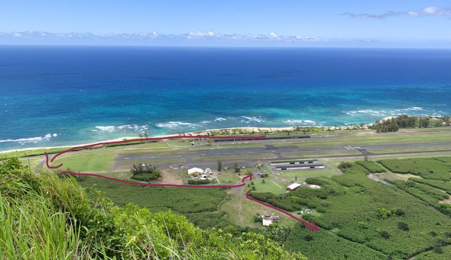
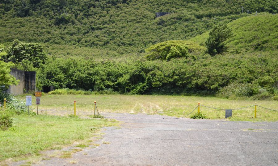
Once you reach the airfield, drive all the way past it. Don’t park in the parking lot you see right off the main road, because you can’t access the trail from there. Once you pass the airfield, there will be a driveway on your left that you can turn into. Take it. Drive all the way down and turn left again, then there will be a parking lot on your left. Park it. Then get out of your car and bop it. Spin it. Flick it. Smash it. Just kidding. You should stretch and hydrate!
Across the street you’ll see a chain across a road, that’s the first entrance. There is a wide path that you’ll follow until you reach the trailhead entrance.
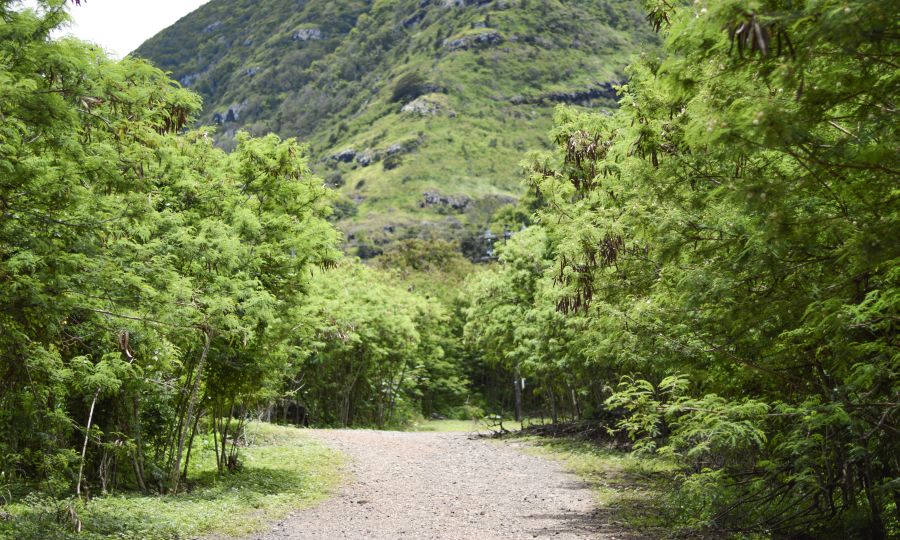
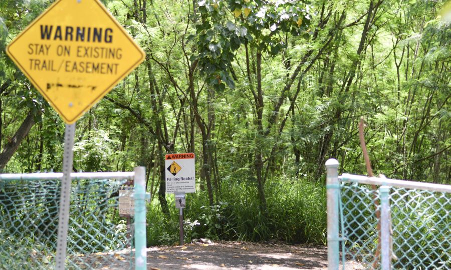
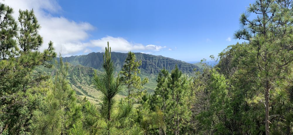
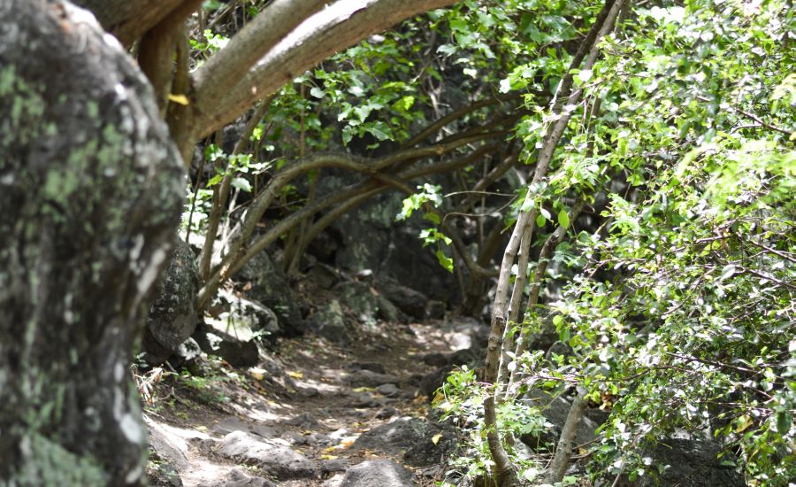
After you enter through the fence, the switchback trail will lead you through storybook woods and rocky terrain, with zero chance of getting lost as long as you stay on the path. All that stands between you and that picnic table lookout is your own sheer determination and willpower!

Don’t forget to enjoy the views on the way to the top. Fo’ real. The views from Kealia Trail are the best on the way up actually. Once you get to the picnic table you can’t really see much because the views are blocked by the trees.
Once you’ve made it here, no one would judge you if this is where you decided to stop and turn back around. It’s a three mile loop trail, and although it’s a switchback it’s still strenuous. Option A: Complete.
But wait, didn’t you say we were going to discuss how to make it through Option B, you might be wondering? We did! Seriously, your recollection skills are uncanny. As you remember, Option B continues past the switchback trail after the picnic table lookout and opens up to a wider path that leads all the way to the summit, and it’s pretty epic. In a rugged, nature-y, earthy, western-y kind of way.
On the other side of the grounds where the picnic table is, you’ll see a wide red dirt path that goes up hill. Follow. That. Path.
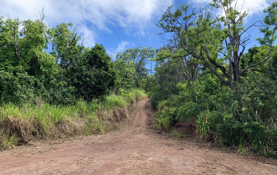
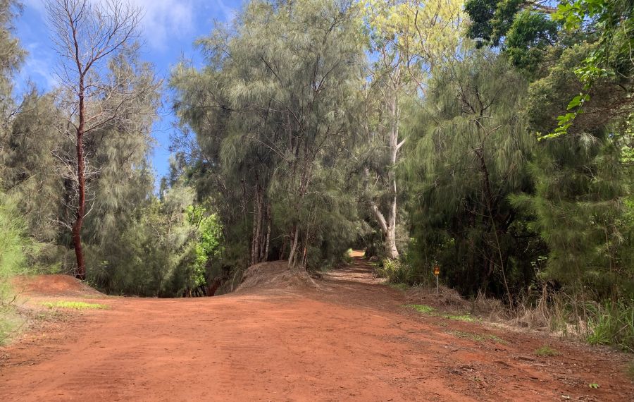
This is the trail that leads to the summit, but it can be just a bit hairy in some places where there are a couple forks. So to clear up any confusion, make sure you go right at this fork…
…and left at this one.
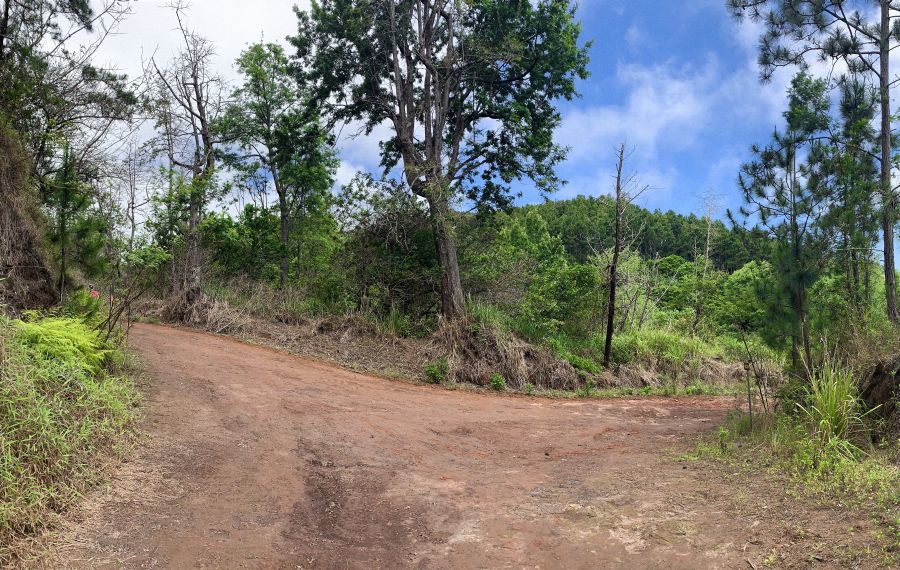
If you forget what these look like, a good rule of thumb for the forks to remember is to choose the path that goes uphill.
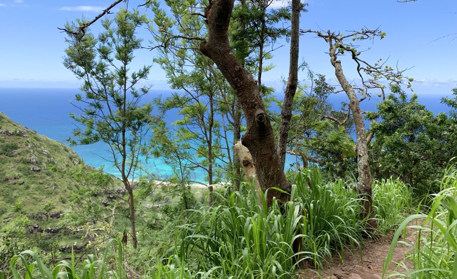
From the second fork, the summit is near, and it’s inviting you to draw near to it and be embraced by its rugged, western, sun kissed arms.
Summit Splendor
The path will narrow, and you’ll reach a small fence (technically the summit) which you’ll cross through to catch the view. And you might have to catch your breath while you’re at it, because the view is so darn gorgeous (and you’ll have just hiked for three and a half miles, who are we kidding?).
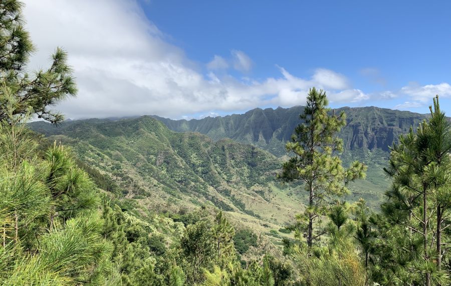
Ahh. Summit glory in all of her wonder and perfection. The mountain air up here is crisp and clean and piney. It’s all one could ever ask for in a hike. It’s easy to lose sense of where you are. It’s like a cross between the vast Wyoming Rockies and the tropical paradise that is Hawaii. The mountain views pristine, completely untouched and undeveloped–something ever more difficult to come by on Oahu. Peeking through the trees and past the mountains are the perfectly sapphire waters of the Pacific, allowing you to glimpse your destiny and at the same moment give thanks for all that this wonderful life is.
If you are the aforementioned crazy, who wishes to proceed on to Kealia Trail Option C, this is where I leave you. The path that takes you to the summit continues down the side of the mountain, and you can [allegedly] follow it all the way down to the Waianae Coast. If you choose this option, it would be wise to have a car parked at Makua (or one of the other beaches nearby) so you can drive back to the North Shore trailhead instead of hiking all the way back. But hey, you’re the uber adventurous one.
Option B’s round trip is just over 7 miles from your car and back, and it’s worth every step. From the trailhead, Option A is one and a half miles up and one thousand feet in elevation. Option B takes you another one and a half miles up the mountain and another thousand feet up in elevation, to give some perspective.
Readers, fellow hikers, adventurers, friends, Kealia Trail is a hike that is not to be overlooked or missed. So go. Get out there and explore this big bad world we get to call home. And if yours and Kealia Trail’s paths ever cross, consider your life a blessed one indeed.

Gabrielle is the founder of Destination Copy, where she writes for businesses within the travel and tourism industry. Surfing is her leisure activity of choice, writing – her greatest intellectual pleasure, and reading – her mental running wheel.


